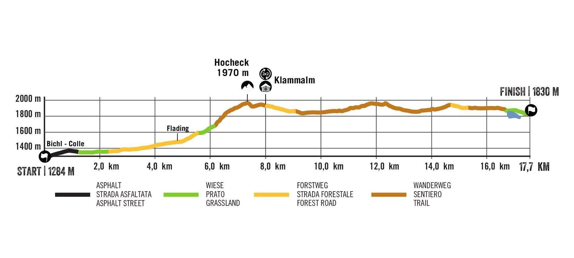
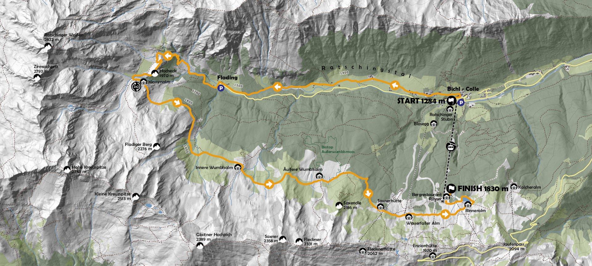
Ratschings Mountain Trail – The Track
The route of the Ratschings Mountain Trail is roughly divided into 4 sections:
Section 1 – The Start
The start is on the bridge, which is the main access road to the lower cable car station of the skiing region. After the start there will be enough space for the starter field on the entire first section of the course.
At first the run is on a tarmacked side road (approx. 1.2 km), before the route continues on meadow tracks and on the old road with a moderate gradient to the head of the valley.

Section 2 – The slope
In Flading, at km 5, we leave the bottom of the valley behind us and on the second section of the route we have to overcome the altitude differential to Malga Klammalm. At the beginning the route follows an old access road, then it continues on more alpine terrain, quickly gaining altitude.
Above the tree line, a special highlight of the race awaits the participants, as the route runs over an almost 2000 m high mountain peak with wonderful panoramic views.
It is now not far to the lower lying Malga Klammalm. This is where the handover zone for the relay runners is located, as well as the spacious second refreshment stop.

Section 3 – The flat part
After Malga Klammalm, the participants reach the third section of the route. A first short section takes the runners slightly downhill on a forestry road to the start of the Ratschings alpine pasture hike. This probably most beautiful section of the entire trail runs with moderate up and down passages mostly above the tree line.
We run through the inner and the outer Malga Wumbls, race past a beautiful lookout point with a “Wetterkreuz” cross and complete the last steep ascent of the race to Rifugio Saxner.

Section 4 – The finish
From Rifugio Saxner, fortified at the fourth and last refreshment stop, the race enters its final section. From here you can look over the last 3 km of the route. The hope of catching up with one or the other competitor will release the last energy reserves for the final stage. First running downhill to Malga Wasserfalleralm, then continuing on undulating terrain to Malga Rinneralm, the noise level of the atmosphere from the finish area increases steadily.
Immediately after Malga Rinneralm the route continues around the reservoir past another “Wetterkreuz” cross. Here the participants can look back over the majority of the already completed route in the valley and along the Alpine meadow path. After the reservoir, a short descent, then a flat run across the meadow towards the finish line for the last sprint and you’re done… You are a finisher of the first edition of the RATSCHINGS MOUNTAIN TRAIL!!